Nov 242020
 

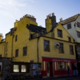
240 Canongate, EH8 8AD

Chessel's Court
Chessel’s Court

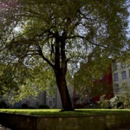
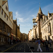
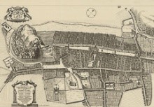
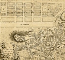
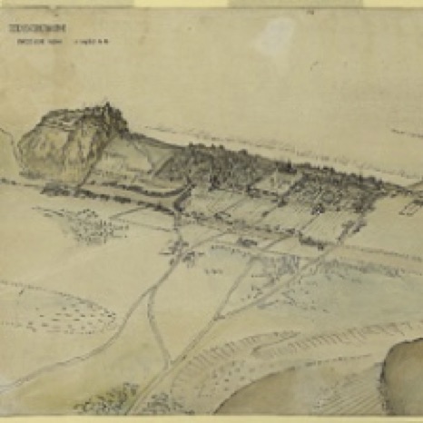
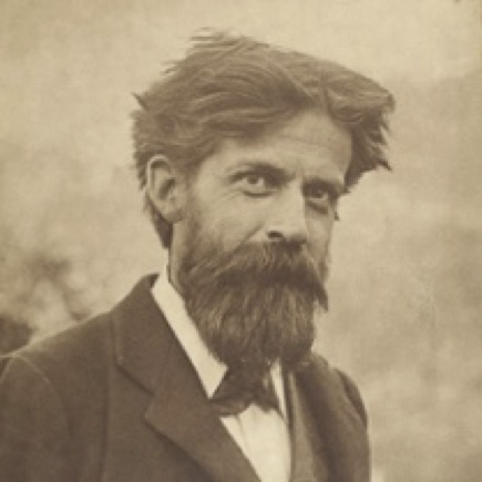
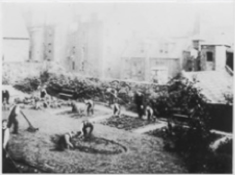
The High Street was the main public space and spine of the original town structure, with enclosures (or ‘closes’) situated on either side. Each enclosure consisted of a dwelling at the top and gardens behind, extending towards the fields further down the valley. As the population grew, the gardens were built over, and, by the 17th century, virtually all green space had disappeared. Dwellings off the street front were accessed through narrow ‘wynds’ and ‘closes’. Chessel’s Court is one example of the 19th-century urban regeneration efforts led by the botanist, philanthropist, pioneer sociologist and town planner, Sir Patrick Geddes (1854-1932) and the Edinburgh Social Union. Geddes and other members of the Union worked closely with architects and local residents to rescue derelict inner-city tenements and transform them into livable spaces; an approach he termed ‘conservative surgery’. This involved creating a network of small community gardens on available open spaces in Old Town, bringing inner-city residents back in touch with nature, light, and air. A botanist by training, Geddes believed that people and their environment evolved together, and the human misery and degradation seen in Edinburgh`s Old Town could be reversed by the systematic improvement of the living conditions of its inhabitants.

More green space towards the top left end of the courtyard.
More green space towards the top left end of the courtyard
Edinburgh Bird`s Eye View looking West c.1450 AD. By Sir Frank Charles Mears, member of the Edinburgh Social Union, 1910.
Edinburgh Bird`s Eye View looking West c.1450 AD, speculative sketch of the historical town showing gardens and fields behind the closes on High Street. By Sir Frank Charles Mears, member of the Edinburgh Social Union, 1910
(© The University of Edinburgh).
Patrick Geddes in Lasswade (© The University of Edinburgh)
Patrick Geddes in Lasswade
(© The University of Edinburgh)
Children working in garden, photograph by Patrick Geddes 
(© The University of Edinburgh)
Children working in garden,
photograph by Patrick Geddes
(© The University of Edinburgh)

Find out more

Nov 232020
 

142-146 Canongate, EH8 8DD

The Museum of Edinburgh

The Museum of Edinburgh is dedicated to telling the history of the city through its unique collection of objects, ranging from the precious to the mundane. In the first-floor exhibition space, in the third room to the left of the staircase, there is an early 17th-century chamber pot on display, excavated from below the buildings of Old Town. Before the introduction of water closets, human waste collected in chamber pots was often tossed onto the streets by maids calling out `guardyloo` (from the French expression `prenez garde à l`eau` or `watch out for the water`), a custom going back to the Middle Ages. This lack of efficient waste management created major problems as the population grew. In 1749, the `Nastiness Act` was passed, restricting the tossing of refuse (or `fulsies`) to the hours between 10 pm and 7 am. Dust carts were introduced and scavengers employed to clean up the streets. Nonetheless, poor sanitation in Old Town remained an issue well into the 19th century, leading to frequent outbreaks of cholera and fevers.

`If any one, from his windows, or doors, or otherwise, shall throw sweepings, foul water, or other nastiness, … by which he tears or defiles the cap or coat of any one passing, that passenger, so injured, may demand and make good in law a double compensation for his damage. But this double reparation cannot be awarded, if the way was not a public one, or if the individual solemnly and fairly proclaimed what was coming, by crying, “Garde l`eau.”` From the 16th-century Flemish manual of criminal law Praxis rerum criminalium by Joost de Damhoudere (Louvain, 1554), cited in Reekiana, or Minor Antiquities of Edinburgh by Robert Chambers (Edinburgh, 1833).

Early 17th-century chamber pot (The Story of Edinburgh in 101 Objects https://edinburgh.org/101/
Nov 232020
 

Tolbooth, Cannongate, Edinburgh

View of Royal Mile and Tolbooth

The stretch of the Royal Mile running from Castle Hill to Blackfriars Street is the oldest part of Edinburgh. Chartered as a royal burgh in the 12th century, the medieval town core saw an immense population boom, growing from an estimated 2,000 inhabitants in the 12th century, to 15-20,000 in the 15th, and upwards of 50,000 by the 17th century. The problems caused by severe overcrowding within the medieval town walls intensified as the city expanded north in the second half of the 18th century. As the well-to-do moved out into the elegant Georgian buildings of New Town, the living conditions of the poor who remained in Old Town rapidly deteriorated. By the 19th century, the district had arguably turned into the worst slum in Britain. This tour will offer a glimpse into the public health issues that arose from overcrowding, poverty, and civic negligence, and review some of the innovative measures developed in the 19th century by city administrators, public health officials, social reformers, and philanthropists to remedy them. 

Bird`s eye view of Edinburgh in 1647 by James Gordon of Rothiemay (The National Library of Scotland https://maps.nls.uk/)
Plan of New Town from A Collection of Plans of the Capital Cities of Europe by John Andrews 1771 (The National Library of Scotland https://maps.nls.uk/). The plan shows the contrast between the winding narrow passages of Old Town, and the wide, airy Georgian boulevards under construction in New Town.