Matjaz Vidmar

Apr 132024
 

Pier Pl, Newhaven, Edinburgh, EH6 4LP

Newhaven Harbour Aerial View.webm - Wikipedia
Source: Danieljksn

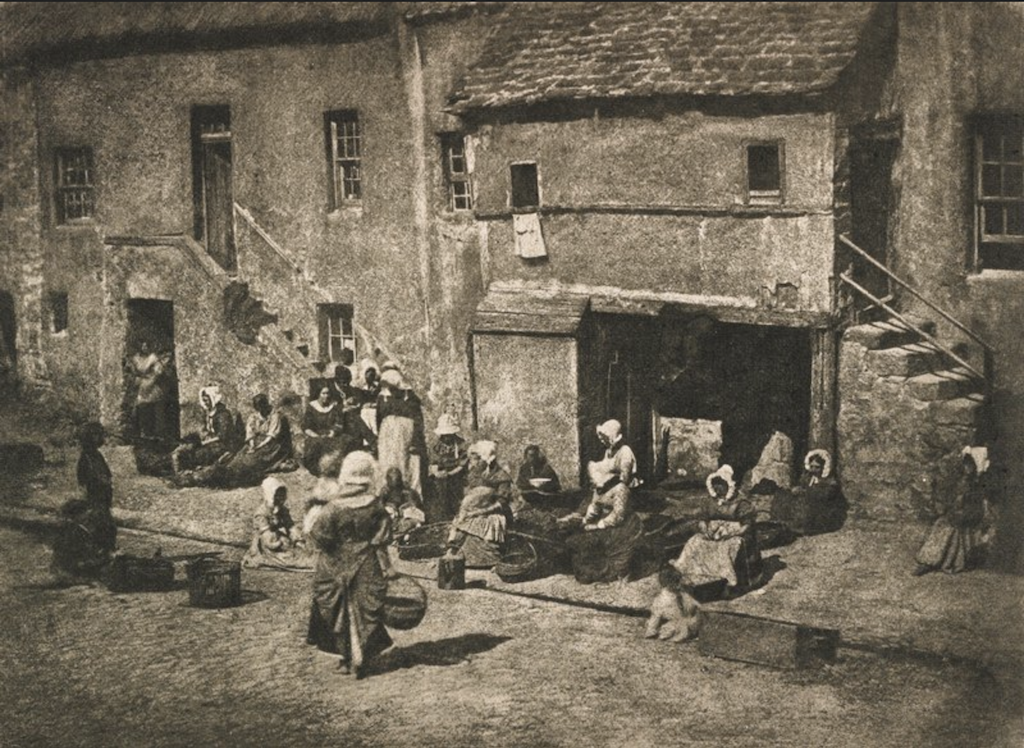
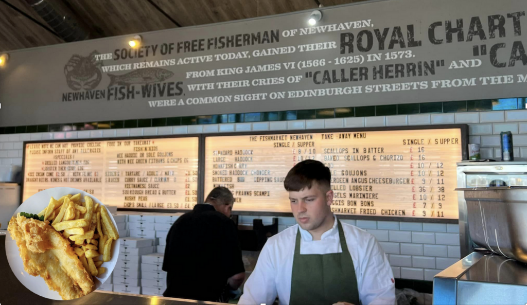
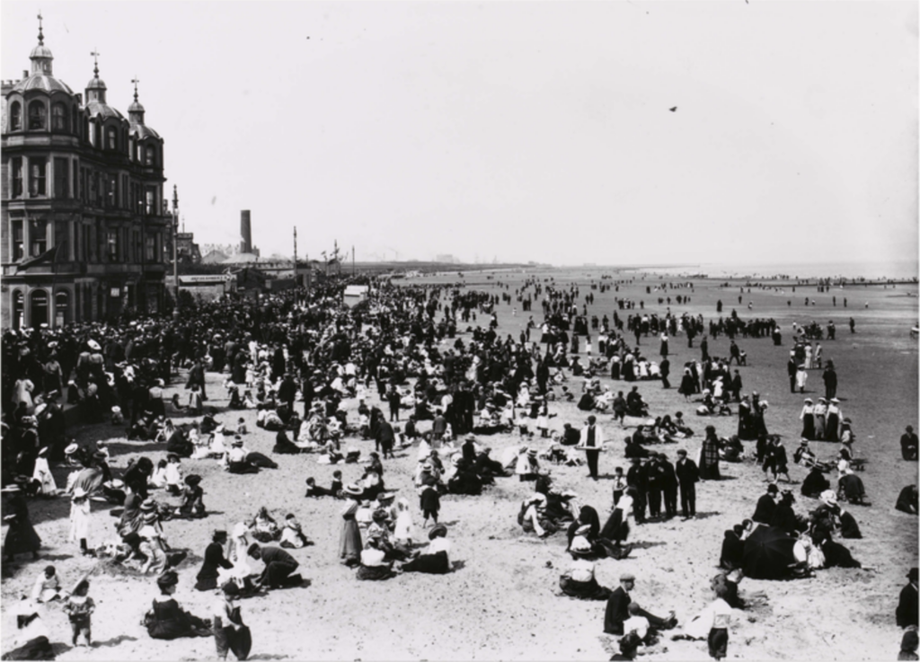
The harbour at Newhaven dates back to the 1480s, when the local fishing community relocated here from the busier trading harbour in Leith, which also gave the new location its name. The area soon expanded as King James IV (crowned in 1488) instigated an expansion of the Royal Scots Navy and a Royal Dockyard was established in Newhaven by 1505, culminating in the construction of arguably the largest warship in Europe of its time, Great Michael (launched in 1511). As James IV and his army were defeated, Newhaven returned to being primarily a fishing port, including servicing lucrative oyster farming in the Firth of Fort; as well as a being the ferry terminal for connections to Burntisland and Lower Largo in Fife. As early as 1572, the Society of Free Fishermen of Newhaven, was formed, thus being one of the oldest friendly societies in Scotland.

Significant port renovations and expansions in the 19th century led to the construction of two lighthouses in on the North breakwater of Newhaven Harbour. The first one was build in 1830 halfway along the breakwater and features a smaller stone tower with a domed roof. Later, in 1869, a 50-foot high octagonal cast-iron tower lighthouse was built at the tip of the breakwater by James Dove and Company. These lighthouses were critical for the deployment of pilot boats from the Newhaven Harbour, with local families being well regarded and dominating this service in the Firth of Forth. Though decommissioned, this lighthouse still has a symbolic light within its glass dome.

Old picture of fishery community with woman in front of houses in between baskets and fishnets
Newhaven Fisheries, ca. 1845, Photographer Robert Adamson from https://collections.artsmia.org
Fish & Chips shop
Traditional fish & chips at the historic Fishmarket restaurant and take-away

Today the Heart of Newhaven community centre is keeping the Newhaven local community and its heritage alive.

Old school which now functions as a community hub
Picture from the Newhaven community centre Heart of Newhaven

Newhaven Village and Harbour https://www.allaboutedinburgh.co.uk/newhaven-attractions-edinburgh Newhaven https://www.undiscoveredscotland.co.uk/edinburgh/newhaven/index.html
Heart of Newhaven community centre https://www.heartofnewhaven.co.uk/

Apr 132024
 

Leith, Edinburgh, EH6 7BZ

undefined
Source: alljengi

Port of Leith was a critical commercial and logistics hub, its harbour being the largest trading centre on the Scottish North Sea coast and the town being considerably larger than the neighbouring Edinburgh. There were several phases of harbour development along the estuary of the Water of Leith, quays connected with moving bridges, like the nearby Victoria Swing Bridge, built in 1874.

On the corner (of The Shore and Tower Street) stands the Signal Tower. Originally a windmill, this is one of the oldest buildings in Leith, built in 1686 by Robert Mylne. In 1805 it was converted into a signal tower from which flags were displayed to let ships know the depth of water at the harbour bar. On the opposite side of the road is the large building of what was the Sailor’s Home, a boarding facility for visiting and homeless sailors started in 1883. It was designed to house 56 seamen, 9 officers and 50 shipwrecked seamen. In front of the building stands the Scottish Merchant Navy Memorial, unveiled in 2010 and commemorating all Scottish sailors, who lost their lives at sea. Its panels celebrate the global shipping routes, perils at sea as well as noting the crucial role of Leith Nautical College and its training ship “Dolphin” in the training of sailors.  

On the harbour quay, there is a preserved harpoon, a remnant of the Leith’s dominant industry of the past – whaling. Since early 17th century Leith whalers sailed North to Arctic waters around Greenland, as whale oil was critical for many industrial and domestic uses. In 1911, Leith had the largest whaling fleet in the world, owned by Christian Salvesen & Son and sailing South towards Antarctica, even establishing a whaling station called ‘Leith Harbour’ on South Georgia. However, the whale oil extraction left quite a bad smell, literally, with a ‘boiling house’ in Timber Bush. As it was owned by Peter and Christopher Wood, the smell was locally called “Woods’ scent bottle” – not something many people missed, when whaling finally ceased in 1963.

The Salvesen harpoon on The Shore in Leith, source UoE blog on the Long shadow of whaling

Leith Local History Society – http://www.leithlocalhistorysociety.org.uk/index.htm
Scottish Merchant Navy Memorial https://www.iwm.org.uk/memorials/item/memorial/87515
Signal Tower http://www.leithlocalhistorysociety.org.uk/buildings/signal_tower.htm

Apr 132024
 

Promenade, Portobello, Edinburgh, EH15 2BH

File:The Promenade at Portobello - geograph.org.uk - 293397.jpg
Source: Sandy Gemmill

The Portobello Promenade is a 2.2 mile (5,000-step) coastal walkway in the suburb of Portobello in the Eastern part of the city of Edinburgh. The adjacent sandy beach is popular for Summer outdoor activities, from surfing and swimming to beach sports. Along the promenade, there are numerous points of interest, such as the exotic Portobello Community Garden, Straiton Place Park with the Prince of Wales Fountain, as well as a host of cafes, leisure facilities and other amenities. Amongst the latter, the most notable is the Portobello Swim Centre and its Turkish Baths, built by City architect, Robert Morham, in 1898. The area is key part of the annual Portobello Art Walk each September.

Historic image of Portobello, from Edinburghcollected.org
Refurbished Portobello baths (1998), picture from Edinburghcollected.org

Portobello Swim Centre – https://www.edinburghleisure.co.uk/venues/portobello-swim-centre
Portobello Art Walk – https://www.artwalkporty.co.uk/

Apr 132024
 

New St, Musselburgh, EH21 6DH

File:Fisherrow Harbour panorama.jpg
Source: Scyrene

Fisherrow is a harbour and former fishing village West of Musselburgh. The fishermen from here used to fish for herring, and later for white fish, prawns and sprats. This is not to be confused with the harbour at in the estuary of the river Esk, which was renown of the shellfish from this area gave rise to the name “Musselburgh”. In fact, there was some healthy rivalry between the two communities, for instance golf tournaments took place between the fishwives of Musselburgh and Fisherrow. The community held a “Box Walk” in September, marking the end of the fishing season, and giving charity to those in need.

Storyboard showing historic pictures and an image of a fishwife with traditional blue coat with yellow and red dress and two fishbaskets on her back
Storyboard on history of fishing in the harbour by East Lothian Council
Fisherrow Harbour on a sunny day

Fisherrow Harbour and Seashore Association https://www.fhsa.org.uk

Apr 132024
 

Linkfield Rd, Musselburgh, EH21 7RG

undefined
Source: Thomas Nugent

The Mussleburgh Racecourse is the second largest in Scotland and has been active since at least 1777, when opened as part of the Royal Caledonian Hunt. The course is 2km long and hosts both flat racing and National Hunt meetings. Quite uniquely, in the middle of the loop, there is the nine-holes Musselburgh Links golf course, dating from at least 1672, and home to the Royal Musselburgh Golf Club established in 1774. Attracting tens of thousands of visitors per year, the Musselburgh Racecourse is home to some of the premier fixtures of the Scottish sports calendar.

Horses making way to start line at Musselburgh racecourse, picture via flickr theedinburghblog

Musselburgh Racecourse https://www.musselburgh-racecourse.co.uk/

Apr 132024
 

Morrisons Haven, Prestonpans, EH32 9RX

File:Prestongrange Museum (9741608889).jpg
Source: marsupium photography

Prestongrange was a key industrial area for hundreds of years. The busy activity included harbour, glass works, pottery, colliery and brickworks. Whilst the workshops and factories have now disappeared, the industrial landscape remains, including a large winding gear, a vast brick kiln and a Cornish beam engine. Thus, following the closure of the Prestongrange coal mine in 1962 (spanning in total over 700 years of coal mining in the area), the site was transformed into an open-air museum with a dedicated Visitor Centre.

Visitors can experience the hubbub of industry that was Prestongrange, from the the first deep shaft in Scotland, which Matthias Dunn of Newcastle sank in 1830 to the Great Seam at 420 feet (128 m), and right to the end of the coal power in the area with the decommissioning of the Cockenzie Power Station in 2013 and the demolition of its two iconic 149m-tall chimney stacks. The ash lagoons created by the power station span the coastline towards Musselburgh, now home to abundant wildlife sheltered by the low woodland.

Video from Out about Sotland via youtube

Prestongrange Museum https://www.eastlothian.gov.uk/info/210593/museums/11878/museums_in_east_lothian/4

Apr 132024
 

W Harbour Rd, Cockenzie, Prestonpans, EH32 0HX

The 1722 Waggonway Project - History Scotland
Source: Ed Bethune, FSA Scot

Scotland’s first ever railway was built in 1722 connecting the harbour at Cockenzie with the nearby market town of Tranent, where coal was being mined. This followed a route used by a more simple wooden track since the 16th century. Alongside the fascinating story of the waggonway, the museum tells the history of the local area, especially the salt making, glass manufacturing, coal mining, as well as herring fishing from the Cockenzie and Port Seaton Harbours.

The Cockenzie Harbour is built on the site of a natural harbour, which was designated a free port by James VI in 1591. With excellent port facilities, the trade with Flanders, in the present day Belgium, and France was particularly strong. Today, the harbour is home to a small fleet of fishing vessels and pleasure crafts.

Cockenzie History http://www2.thesetonfamily.com:8080/gallery/Cockenzie_House_History.htm
1722 Wagonway Museum https://www.1722waggonway.co.uk/museum

Apr 132024
 

Aberlady Bay Car Park, Longniddry, EH32 0QB

File:Remains of Miniature Submarine. - geograph.org.uk - 201385.jpg
Source: DD

Along the coastal path connecting Aberlady with North Berwick, one can see many curiosities including the wreck of two World War II X-type midget submarines in Aberlady Bay.  These vessels were about 16 metres (52 ft) long, only big enough for a crew of four: a commander, a pilot, an engineer and a specialist diver. They were powered by a diesel engine when on the surface and an electric motor when underwater. These midget submarines were exclusively used for special coastal operations, for instance the 1943 raid on the German battleship Tirpitz in a Norwegian fjord and as guide boats for the 1944 Normandy landings.

The two submarine skeletons in Aberlady Bay were exclusively used for training, firstly as part of preparing for missions, as well as targeting research and for anti-submarine areal defence. It was as part of this latter use that they were towed and moored in the shallow waters near Aberlady, so they could be part of trials launched form the nearby East Fortune airfield.

3D reconstruction of the submarines from Wessex Archeology via the Society for Nautical Research, where you can also listen to a podcast on the reconstruction project

Midget Submarines in Aberlady Bay https://awesomeaberlady.com/aberlady-bay-midget-submarines/

Apr 132024
 

School Rd, North Berwick, EH39 4JU

Who We are — Coastal Communities Museum
Source: East Lothian Council

The Coastal Communities Museum is home to a varied set of collections and exhibitions, exploring and recounting the past and present life of the coastal communities in the North Berwick coastal ward. Local history starts 400 million years ago, when in a dramatic way the nearby extinct volcano, now a grass covered hill, the Law, was formed. North Berwick was a critical centre and port throughout the history, as it was the quickest way to connect the South East of Scotland with Fife peninsula to the North. Critically important was the ferry route to St Andrews, a major pilgrimage destination in medieval times.

More recently, the beautiful sandy beaches to the West and stunning cliffs to the South-East have been attracting numerous visitors to the town, especially since the construction of the railway line in the mid-19th century. North Berwick is also known as one of the earliest and premier centres for golf, having had established golfing groups since 18th century and one of the world’s oldest official golf clubs, formed in 1832.

Coastal Communities Museum  https://www.coastalmuseum.org/
History of Golf in North Berwick http://www.northberwick.org.uk/origins.html

Apr 132024
 

Tantallon, EH39 5PN

File:Tantallon Castle (13893797521).jpg - Wikimedia Commons
Source: marsupium photography

Tantallon Castle’s ruins sit on top of a sea cliff opposite the Bass Rock, and represent the last curtain castle constructed in Scotland, dating from mid-14th century. The castle’s dominant “curtain wall” is made from distinct red sandstone and spans over 15 metres (49 ft) high, 3.6 metres (12 ft) thick, and around 90 metres (300 ft) long, with ruined towers on each side. The castle was besieged, attacked and damaged through some of the decisive moments in Scottish history, from the Bishop’s Wars to the 1651 Cromwell’s invasion, the latter leaving it ruined. Since, the castle has been quarried for stone, inspired a number of artworks, and served in training exercises in World War II to the nearby East Fortune airfield, which is now the National Museum of Flight. Tantallon is open to visitors, managed by the Historic Environment Scotland.

Visit the doocot which might be the best preserved part of the castle
View from the castle towards Bass rock, picture from Historic Scotland

Tantallon Castle https://www.historicenvironment.scot/visit-a-place/places/tantallon-castle/