Tolbooth, Cannongate, Edinburgh
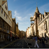
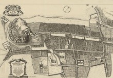
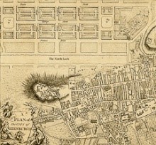
The stretch of the Royal Mile running from Castle Hill to Blackfriars Street is the oldest part of Edinburgh. Chartered as a royal burgh in the 12th century, the medieval town core saw an immense population boom, growing from an estimated 2,000 inhabitants in the 12th century, to 15-20,000 in the 15th, and upwards of 50,000 by the 17th century. The problems caused by severe overcrowding within the medieval town walls intensified as the city expanded north in the second half of the 18th century. As the well-to-do moved out into the elegant Georgian buildings of New Town, the living conditions of the poor who remained in Old Town rapidly deteriorated. By the 19th century, the district had arguably turned into the worst slum in Britain. This tour will offer a glimpse into the public health issues that arose from overcrowding, poverty, and civic negligence, and review some of the innovative measures developed in the 19th century by city administrators, public health officials, social reformers, and philanthropists to remedy them.